Fremont County
Austin, Fremont County, Iowa
Location
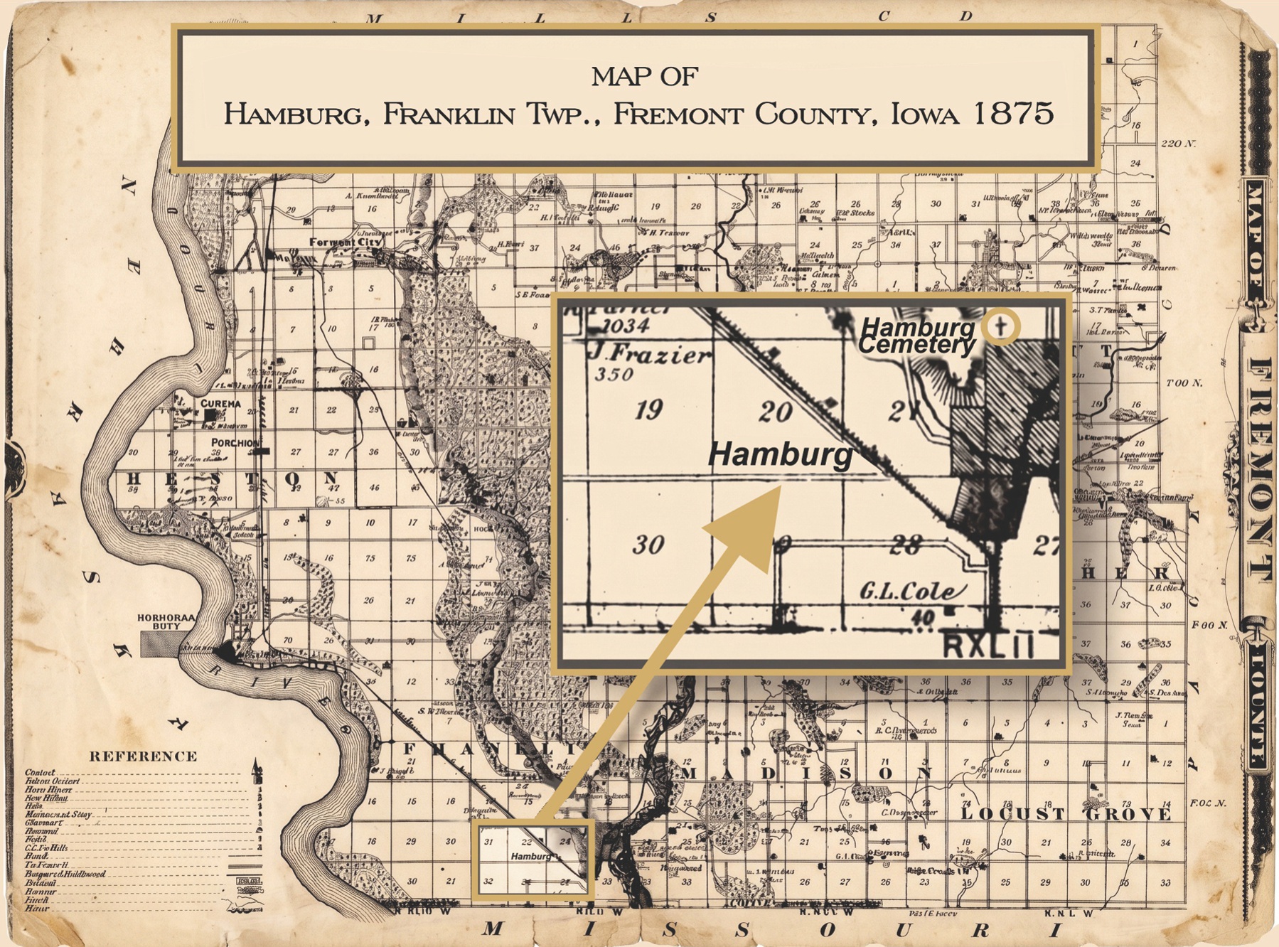
Austin was located “about seven and a half miles south of the town of Sidney and situated in the northeast quarter of the southeast quarter of section 10. Austin consisted of but one or two houses, the principal one of which was the store and residence of A. H. Argyle” (1). It sat on the west bank of Nishnabotna River” (2).
History
The community was not founded by the Latter-day Saint pioneers but was one in which they resided. The early residents of what became Fremont County objected to the LDS presence in the region. “With increase of population the balance of power began to change and opinions adverse to Mormon government and Mormon doctrines began to find expression in overt action. In October 1848, a public meeting for political purposes was called and held at the Waubonsie Indian Agency's Cabin, some four or five miles northwest of the present site of Tabor, near the residence of John Lambert, son of Ezekiel Lambert. There were perhaps forty or fifty people present, and among them were I. D. Blanchard, L. W. Platt, G. B. Gaston, D. P. Matthews, Charles W. Tolles, J. B. Hall, and the Rev. John Todd. During the progress of the meeting a paper was drawn up and signed, petitioning the legislature to organize a county in southwestern Iowa, with the belief that it could be successfully controlled by the Gentiles. J. E. Hall and John Todd, who were then in the county in search of an eligible site for a new town contemplated by a body of men in Oberlin, Ohio, were about to set out across the state on their return home. To them the petition was entrusted, with instructions to place it in the hands of the first member of the Iowa legislature that they might find. They soon after set out for Ohio on horseback but found no member of the legislature until they reached Fairfield. Here they were directed to a Mr. Baker, a blacksmith, whom they found in his shop at work. On informing him that they had a little business which they wished through him to present to the legislature, he seated himself on his anvil and gave them audience. They at once presented him the petition entrusted to them, and volunteered cogent arguments of their own, in their endeavor to further the cause of the residents of the Missouri bottom and requested him to submit the same to the next General Assembly of the state. That petition was never heard of until many years after. It was then learned from Mr. Baker himself, who afterwards removed to Council Bluffs, that he judged it all a Mormon project, and that he had never presented the petition to the legislature at all. Mr. Baker's hasty judgment hardly does the General Assembly, as a body, justice, but it is possible men were more justifiable in those early days than now in entertaining opinions of a suspicious character.”
“Whether this petition had any influence upon Mr. Baker when he voted is a thing from its very nature not to be determined. In the year in which he was to present it (1849) the county was, nevertheless, organized, but whether by reason of a petition is not known. Previous to that year, the county was attached to Polk County for political and judicial purposes. It began an independent existence when David M. English, the appointed organizing sheriff, and the people, by the selection of officers, declared themselves an official part of the great state of Iowa.”
“The first election, pursuant to the proclamation of the organizing sheriff, was held in April 1849, at which David Jones, William K. McKissick, and Isaac Hunsaker were elected county commissioners; Milton Richards, clerk of district court; A. H. Argyle, clerk of county court, and David M. English, sheriff; T. L. Buckham, treasurer and collector; S. T. Cromwell, inspector of weights and measures” (3).
Describing multiple communities where the Latter-day Saints lived, including Austin (or Austen), one turn-of-the-century historian wrote, “Strictly, they were not villages or even hamlets, merely the collection within easy distance of a handful of farmhouses in a grove on a creek, with a school or church and perhaps a mill or trader's stock. They resembled rather the ideal farm communities or settlements of some modern sociologists” (4)
“At the time of the organization of the county, the county seat . . . was at Austin in what is now Franklin township . . . [In the store/home of A. H. Argyle], the county commissioners met, and here the first term of the district court was ‘begun and holden.' The proceedings of both of these tribunals, while of great future importance, were void of all pomp and circumstance and almost free from dignity. The county court was held in the storeroom of Mr. Argyle, the gentleman who is clerk. The commissioners, when in session occupied seats upon nail kegs or boxes, or upon the counter. Everything was done decently and in good order, and there were few, if any, mistakes made either in legislation or in the execution of law.”
“But the glory of Austin has departed and the place that knew it once knows it no more forever. The re-location of the county seat was the weight that pulled it down—the wound that dilled it. It was once known far and near as the capital of Fremont County, the old United States Gazetteer for 1849 so mentions it. There was a good road, at least a plain one, running through the place from east to west and one from north to south, and Mr. Argyle operated a ferry across the Nishnabotany, in those days the only one for miles on either side of the river” (5).
“A description of [Mr. Argyle's store] may prove both interesting and valuable, and to insure accuracy, will be given to the reader in the very language and form of the articles of contract under which it was built:
This article, made and entered into between Thomas R. King, of the first part, and Thomas E. Tootle, of the second part, both of the county of Atchinson and state of Missouri.
Witnesseth, that I, the said King, agree to furnish all the materials and built a hewed-log store-house 20 by 26 feet large, one story high, with shingle roof, a good jointed floor, two doors, two windows with shutters; counter on one side, and end shelving on two sides and one end, at the direction of the said Tootle six drawers under the base shelf of one side; to be ceiled overhead with good seasoned plank, or will be lathed and plastered, the house to be white-painted out and inside with lime and sand, the corners to be sawed down, the logs for the above building to face, when hewed, not less than 12 inches. Said building is to be finished complete for use, of good materials, and to be done in a good and workmanlike manner, by the tenth day of April next. For which the said Tootle is to pay said King one hundred and five dollars.”
Given under our hand this 8th March 1848. Thomas R. King and Thomas E. Tootle.
“This building subsequently passed into the hands of A. H. Argyle, and to further history, as a courthouse” (6).
Apparently, Mr. Argyle's store also served as the post office. It was located four miles northeast of Hamburg on the west bank of the Nishnabotna River. It was established on August 23, 1847. It was rename Hamburg on February 11, 1860 (7).
Cemetery
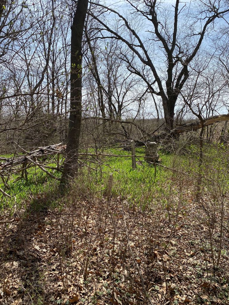
The Buckham Cemetery is located near the Austin settlement.
Possible Burials
| Name | Birth Date | Death Date |
| Eliza Jane Miller Argyle | 13 Mar 1812 | 9 Dec 1849 |
| Julia Van Vliet English | Jul 1848 | 17 Jan 1850 |
| Mary H. Buckham | 1846 | 18 Dec 1852 |
| Jennitta Kirtley Miller | 1 Oct 1771 | 1854 |
| Andrew W. Buckham | Aug 1858 | 28 Dec 1858 |
| William A. Singleton | 1 Sep 1852 | 14 Feb 1861 |
| Catherine B. Argyle Wheelock | 18 Apr 1837 | Apr 1861 |
| Peter R. Buckham | 6 Sep 1844 | 20 Jan 1869 |
Bibliography
- Iowa Historical Company, History of Fremont County, Iowa, Containing A History of the County, its Cities, Towns, Etc.: a biographical directory of many of its leading citizens, war record of its volunteers in the late rebellion, general and local statistics, portraits of early settlers and prominent men, history of Iowa and the northwest, map of Fremont county, constitution of the state of Iowa, reminiscences, miscellaneous matters, etc. (Des Moines: Iowa Historical Company, 1881), 376.
- Guy Reed Ramsey, Postmarked Iowa: A List of Discontinued and Renamed Post Offices (Crete, Nebraska: J-B Publishing Company, 1976), 167.
- Iowa Historical Company, History of Fremont County, Iowa, 372-373.
- Clyde B. Aitchison, The Mormon Settlements in the Missouri Valley. A Paper Presented by Clyde B. Aitchison, of Council Bluff, Iowa, before the annual meeting of the Nebraska State Historical Society, January 11, 1899 (Lincoln, Nebraska, 1907), 23.
- Iowa Historical Company, History of Fremont County, Iowa, 376.
- Iowa Historical Company, History of Fremont County, Iowa, 377.
- Ramsey, Postmarked Iowa: A List of Discontinued and Renamed Post Offices, 167.
View list of community residents
Bartlett
(Osage)

Map from the 1875 Atlas of Fremont County, Iowa, courtesy Iowa GenWeb
While it is not certain that the town of Osage was in the same location as the present-day town of Bartlett, the latter is at least in the same general area. Osage was the name of a post office from 1851 to 1859 and was located "in the northwestern part of Scott Township." (1)
Pioneer James Holt recorded in 1847, "The next spring, Brigham sent word for us to come back to the Bluffs. We were now without provisions and Emmett took a horse and started on ahead to obtain means to get provisions; he agreed to meet us at a certain place, but did not until we got to Mousquite Creek, near our journey's end and we suffered greatly for want of food, but by hunting wild animals and fowls, we were kept from starving. At the Bluffs our company was broken up. Emmett and a few of us went down on the Waupensee Creek and took up farms, in Fremont County , Iowa, we sowed buckwheat, planted potatoes and raised a crop.
“My first child by my wife Parthenia died on the 10 th of August 1847. We remained here for several years and began to accumulate means. There was all manner of wild fruit, grape, raspberry, blackberry, mulberry, strawberry and nuts of all kinds that would grow in cold climate, a great amount of wild game, deer, elk, coon, turkeys and other fouls, fish, honey bees, all kinds of timber." (2)
The "Waupensee Creek" James Holt wrote about was actually Wabonsie Creek. Wabonsie Lake can be seen in the above map of Scott Township. Holt and his wife, Parthenia Overton, gave birth to a son, James Overton Holt, on 8 October 1848. The baby's birth record lists him as being born in Bartlett, Fremont, Iowa.(3) Thus, it is assumed that the family lived in Barlett.
Click here to see a record of the travels of the Holt family
Notes:
- "Abandoned Towns, Villages and Post Offices of Iowa," reprinted from The Annals of Iowa, vols. 17 and 18, 1930-1932 by D. C. Mott.
- Maurine Winsor Farnsworth Thompson, James and Mary Pain (Payne) Holt, James and Parthenia Overton Holt: Ancestors and Descendants (published by compiler, 1995), 46.
- Family Data Collection, http://iagenweb.org/fremont/births/all_births_year_order.htm.
List of community residents forthcoming
Dawsonburg
Location
Dawsonburg is located within Green Township (1).
History
Jacob Dawson appears to have been a prominent resident and likely the one for whom the community of Dawsonburg was named. He owned the newspaper, The Frontier Guardian and Iowa Sentinel, which was printed in Kanesville (2). He also acted as a “Claim and General Land Agent” for Fremont and Mills counties (3). He operated out of Kanesville in this occupation, also (4). At the time he bought The Frontier Guardian and began editing the same under its new name (i.e. - The Frontier Guardian and Iowa Sentinel) in February 1852, he claimed to have had some editing or newspaper management experience previously (5). In fact, he had worked for the Pittsburgh Gazette. The Frontier Guardian spoke very highly of Dawson, saying that he was “not a Mormon, but apparently one of those liberal minded, unassuming men, whose well known qualifications for the business cannot fail to render him an acceptable citizen” (6). Dawson was also a lawyer who worked out of the newspaper office and “practice[d] in the 6 th Judicial District, of Iowa” (7). He later moved his law office to Sidney, Iowa (8). He eventually sold his interest in the paper to A. C. Ford, who apparently was his business partner at one point. Ford eventually had to quit printing the paper because he was losing money on it (9).
Dawsonburg had a post office from February 14, 1851 to January 14, 1858. It was run by Jacob Dawson (10).
Cemeteries
There is a Dawsonburg-Gaylord Cemetery in Green Township of Fremont County. Apparently no stones or records indicate the burial of any of the Dawson family in the cemetery (11).
Notes:
- Guy Reed Ramsey, Postmarked Iowa; A List of Discontinued and Renamed Post Offices (Crete, Nebraska: J-B Publishing Company, 1976), 166-67; http://iagenweb.org/fremont/maps/abandonedtowns.htm (accessed 10-04-2006); Richard Kearnes, “Dawsonburg or Gaylord Cemetery,” http://www.angelfire.com/ia/footprintsintime/footprintscemetery.html.
- Myrtle Stevens Hyde, comp., Kanesville Advertisements (Ogden, UT: Myrtle Stevens Hyde, 1993), 205.
- Hyde, Kanesville Advertisements, 242-243.
- Hyde, Kanesville Advertisements, 179.
- Hyde, Kanesville Advertisements, 144.
- Myrtle Stevens Hyde, comp., Kanesville Conditions (Ogden, UT: Myrtle Stevens Hyde, 1997), 97.
- Hyde, Kanesville Advertisements, 147, 191.
- Hyde, Kanesville Advertisements, 213, 233.
- Hyde, Kanesville Conditions, 110, 122.
- Ramsey, Postmarked Iowa; A List of Discontinued and Renamed Post Offices, 166-67; D. C. Mott, “Abandoned Towns, Villages and Post Offices of Iowa,” The Annals of Iowa, vols. XVII-XVIII, 1930-1932, contributed to the website by Gail Harper as “Abandoned Towns of Fremont County,” http://iagenweb.org/fremont/maps/abandonedtowns.htm (accessed 10-04-2006); “, Richard Kearnes, “Dawsonburg or Gaylord Cemetery,” http://www.angelfire.com/ia/footprintsintime/footprintscemetery.html.
- “ Dawsonburg-Gaylord Cemetery, Green Twp., Fremont County, Iowa,” http://iagenweb.org/fremont/cemetery/dawsonburggaylordcem.htm; Richard Kearnes, “Dawsonburg or Gaylord Cemetery,” http://www.angelfire.com/ia/footprintsintime/footprintscemetery.html.
List of community residents forthcoming
Hamburg

Painting: Hamburg by Moonlight, courtesy IAGenWeb 2004
Link to Fremont County pictures: http://iagenweb.org/fremont/gallery/historical-view.htm
Hamburg, Iowa is located in Franlkin Township, described in History of Fremont County, Iowa as "one of the wealthiest and best in the county." (1)
From History of Fremont County, Iowa:
"THE TOWN OF HAMBURG.
"The metropolis of Fremont county is the town of Hamburg. Its location is peculiar, being almost exactly in the southwestern corner of the state, on sections 21, 22, 27, 28. in township 67, north of range No. 42, west of the 5th principal meridian. In that vague and undefined period known as 'long ago,' there was a steamboat landing on the Missouri river a little below the site of the present town. This landing was called 'the narrows,' 'Lewis' landing,' and perhaps by other names. Very many of the settlers now living in the county remember that where the town now stands once grew rosin weeds and 'cat-tails' thick and rank and tall as a man. Up the valley in which the town is situated and along where Main street now runs, the weeds were so large and thickly sown as to render passage almost impossible--equal to a cane-brake.
"To this uninviting locality first came Augustus Borchers in 1847. Mr. Borchers was fresh from Germany, and had come to the new world 'to seek the fortune,' as the phrase goes. Here, at the foot of 'the bluff,' near where the fine public school building now stands, he opened a store for the purpose of trade with the Indians and the pioneers. At last Mr. Borchers 'builded a city.' Late in the year 1858, the town was surveyed and laid off by Col. Wm. Dewey and A. F. Harvey. The original proprietors of the town were Aug. Borchers, Job Matthews, A. Travis, Henry Brumbick, and Harvey & Rector. The town was christened Hambuerg, by Mr. Borchers, in honor of his birth-place, the famed free city of the Fatherland. The first residence was that of Mr. Borchers, where he now lives. The first business house in the place was a two-story log building erected and occupied by Jacob McKissick in 1858.
"The new town gradually increased in importance. The landing known as 'the narrows,' was now called Hamburg landing. To this point goods were shipped from the eastern markets destined for Frankfort, Clarinda, Bedford, Quincy, and other points in southwestern Iowa, and hauled to their destinations in wagons. The town became quite a trading point, and was known far and wide. April 1, 1867, the town was incorporated, and in December of the same year, the first railroad, the K. C., St. J. & C. B., was built to the place. February 9, 1876, it was declared to be a city of the second class.
"The town is divided into four wards. The first ward comprises all the territory within the city limits west of the center of Main street and north of Willow creek. The second ward comprises all that portion of the city east of the center of Main street, north of Willow creek and south of 'G' street. The third ward is included in the territory within the city limits south of Willow creek. The fourth ward consists of the territory east of the center of Main street and north of 'G' street. There have been added to the town since it was originally laid out the following additions: Nuckolls', Phelps' Railroad, and East Hamburg. Phelps addition was added November 11, 1874. The dates of the annexation of the others are not accessible." (2)
"Owing to the failure of very many of the citizens of the place to contribute information and otherwise aid in the preparation of this history, no very full and accurate description of the town of Hamburg and its history can be given. The people have seemed too much engrossed with personal matters and concerns to co-operate with the publishers in setting forth the character of their town as it should be, and have withheld certain information obtainable from no one but themselves." (3)
"POSITION AND DESCRIPTION.
"The town is situated immediately on the west side of the Nishnabotany river about three and a half miles above where that stream empties into the Missouri, and about three miles east of the eastern bank of the 'Big Muddy.' The streets run north northeast and south southwest, and nearly east and west. Protecting the northern portion of the town like a huge parapet or Chinese wall, rises on the west a bluff, from the top of which a clear view of portions of the states of Iowa, Missouri, Kansas, and Nebraska, may be seen on almost any day. Few, indeed, are those who visit Hamburg and do not ascend this huge promontory and 'view the landscape o'er.' Peru and Nebraska City, Nebraska, Watson, Missouri, Riverton and Eastport, Iowa, are all plainly visible from the eminence. The town itself is about a mile and a half in length by half a mile in width. Its business streets are well built with fine, substantial buildings. The pominent buildings are those of Frank Gilman, the Hamburg House, Booton's Opera House block, the Post-office block, etc." (4)
Notes:
- History of Fremont County, Iowa, Containing a History of the County, Its Cities, Towns, Etc.: A Biographical Directory of Many of Its Leading Citizens, War Record of Its Volunteers in the Late Rebellion, General and Local Statistics, Portraits of Early Settlers and Prominent Men, History of Iowa and the Northwest, Map of Fremont County, Constitution of the State of Iowa, Reminiscences, Miscellaneous Matters, etc. Illustrated (Des Moines: Iowa Historical Company, 1881), 548.
- History of Fremont County, Iowa, 548-549.
- History of Fremont County, Iowa, 549.
- History of Fremont County, Iowa, 549-550.
List of community residents forthcoming
Maggard's Settlement
Location
Maggard’s Settlement was located in the very northwest corner of Scott Township in the neighborhood of present-day Bartlett in Fremont County, Iowa.
In the advertisement section of Orson Hyde’s Frontier Guardian, it mentions a plot of land for sale in the northern part of Fremont County, north of Mr. Maggard’s place. The newspaper describes the settlement: “plenty of good timber, and directly in the neighborhood of the rushes (1).”
In addition to the Frontier Guardian, the Weekly Tribune located in Liberty, Missouri, in 1846 referred to Mr. Maggard and others residing in the “Indian-country” above the Missouri state line (2).
History
On September 26 and 27, 1830, the Indian Removal Act exiled bands of Chippewas, Ottawas, and Pottawattamies to a territory on the east side of the Mississippi River, namely Kansas (3, 4). From these bands a group of about 150 were sent to the Council Bluffs area in 1837 and 1838. By treaty the people held the right to stay for a number of years, but were expected to be removed again in December of 1848.
Some years after the Pottawattamies had settled, the Latter-day Saints made their exodus from Nauvoo to Iowa and presently began establishing their communities, buying land from the full- and mixed-blood Indians (5). These “Half breeds” built their society around agriculture; peas, corn, potatoes, and other garden vegetables grew abundantly in the fertile soil. Additionally, they adopted many of the white settlers’ ways and continued marrying interracially. In 1846 Sub-agent Richard S. Elliot, in supervision over the Pottawattamie Indians, observed the influx of LDS members:
"There is at this time, and has been for several months, a large number of Mormons (supposed to be 4,000 to 8,000) in the Indian country. They have passed into the Potawatomie Country at the Council Bluffs... The sub-agent at that place reports that they are conducting themselves well, and do not seem disposed to interfere at all with the Indians... (6)”
Not much is known about Mr. Maggard; he moved with his wife Lucy Ann Davis from the Benton’s Port Branch in Van Buren County and settled in Fremont around 1844 (7). In October of that year in the Liberty Weekly Tribune, his home is considered one of the “many very excellent houses of accommodation” en route to Council Bluffs: “Many of the Mormons have purchased out the ‘Half breed’ claims and are tolerably comfortably fixed. A good Dinner, Breakfast, or Supper can be attained at Mr. Maggard, who lives at the Allcolt place (8).”
The author of the article continues to describe the Mormons: very hypocritical in nature, claiming to be a member of the only true church while participating in activities like gambling, drinking, and swearing. He concludes that Mormon doctrine would result in corruption if it were spread worldwide (9).
The Frontier Guardian listed a range of settlements and camps spread throughout Harrison, Pottawattamie, Mills, and Fremont County where subscribers’ newspapers could be obtained. “David Maggard” was among the names provided. The article continues, as follows:
“All such as are interested in these various places should agree together and designate some man to be your neighborhood Postmaster to receive the papers for you. There are complaints made by some that they do not get their papers, and we have been [illegible] up the [illegible] possible for us to remember all these little particulars, and we have therefore recommended the above course. Hereafter, when you call for papers, tell us where you wish them sent, as we are makings new Mail Book, and we will try to accommodate you (10).”
Maggard resided near the Mills County line from between four to ten years, staying as late as September of 1849 and leaving before the 1850 US Federal Census.
Besides David Maggard, the only other reference to the settlement is the marriage of Thomas Avery and Lydia Harrington. This couple, the Harrington family, and Charles Edward Avery, who married Mary Miranda Harrington, lived in the Bartlett area in 1850 according to the US Federal Census. Thomas and Lydia moved to the Platteville Township in Mills County sometime before 1856 with their daughter Viola (11), and later left with the Arba L. Lambson Company in 1861 (12).
Daniel and Harriet Harrington, siblings of Lydia, left the church to become members of the Reorganized LDS church. In 1860, Daniel became the first president of the RLDS “Nephi Branch” in Egypt of Mills County (13), located about two miles north of Bartlett (14).
Marriages
One marriage, conducted by Calvin C. Pendleton, occurred at Maggard’s Settlement on the 29th of April in 1849: Thomas Avery, 20 years of age, and Lydia Harrington, age 22 (15).
Notes:
- Hyde, Orson. “Advertisements.” Frontier Guardian, Vol.1, No. 15, Aug. 22, 1849.
- Williams, John R. and Robert H. Miller. “Correspondence of the Tribune: Council Bluffs, October 16, 1846.” The Weekly Tribune, Vol. 1, No. 32, November 7, 1846.
- Babbit, Charles Henry. “Early Days at Council Bluffs.” (Washington, D.C. : Press of B. S. Adams, 1916) 25.
- Holmes, Gail. “Untitled Account on Pottawattamie/Ottowa/Chippewa or Algonkian Indians.”
- Williams, John R. and Robert H. Miller. “Correspondence of the Tribune: Council Bluffs, October 16, 1846.” The Weekly Tribune, Vol. 1, No. 32, November 7, 1846.
- Babbit, 42.
- Bentonsport Branch Records, Van Buren, Iowa, 1842-1844.
- Williams, John R. and Robert H. Miller. “Correspondence of the Tribune: At Home, November 2, 1846.” The Weekly Tribune, Vol. 1, No. 32, November 7, 1846.
- Williams, John R. and Robert H. Miller. “Correspondence of the Tribune: At Home, November 2, 1846.” The Weekly Tribune, Vol. 1, No. 32, November 7, 1846.
- Hyde, Orson. “Home Regulations.” Frontier Guardian, Vol. 1, No. 10, June 13, 1849.
- Iowa State Census Collection, 1836-1925: 1856.
- Pioneer Overland Travel.http://history.lds.org/overlandtravels/pioneerDetail?lang=eng&pioneerId=44670
- Ellis, Corrinne. “Harrington, Daniel B.” Iowa GenWeb. May 6, 2003. http://iagenweb.org/boards/mills/obituaries/index.cgi?read=29466
- Reorganized Church of Jesus Christ of Latter-day Saints. “Died.” True L. D. Saint’s Herald, Vol. 21. (Plano, Kendall Co. Illinois, 1874) 571.
- Pottawattamie County Marriage Records.
Fisher's Grove/Manti, Fremont County, Iowa
Location
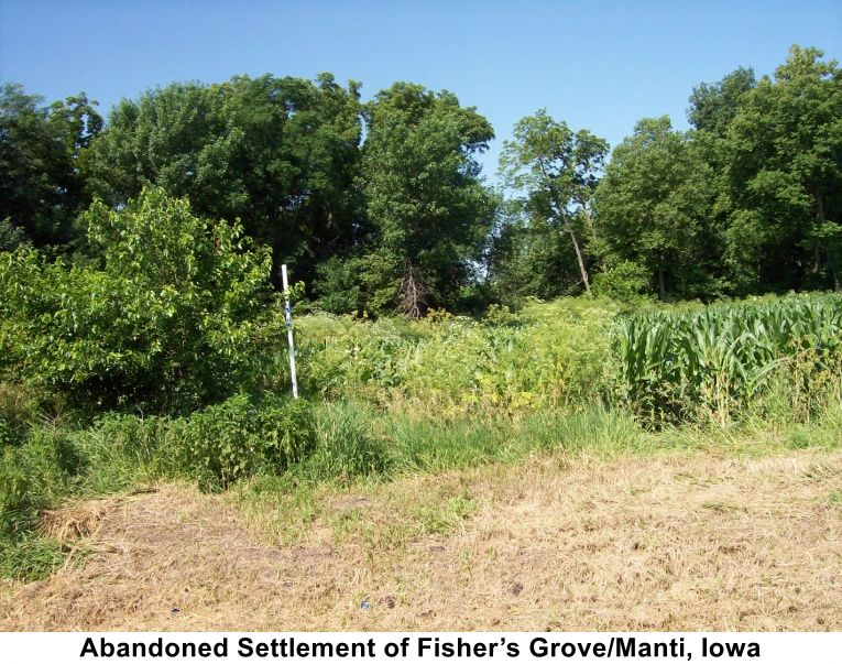
 Fisher's Grove is located in southwestern Iowa, three to five miles
southwest of Shenandoah and approximately 50 miles southeast of Council
Bluffs. During the initial settlement of Fisher's Grove, walnut trees
covered the area, and Fisher Creek, Walnut Creek, and the Nishnabotna River
bordered the settlement and provided adequate water resources for settlers.
Fisher's Grove is located in southwestern Iowa, three to five miles
southwest of Shenandoah and approximately 50 miles southeast of Council
Bluffs. During the initial settlement of Fisher's Grove, walnut trees
covered the area, and Fisher Creek, Walnut Creek, and the Nishnabotna River
bordered the settlement and provided adequate water resources for settlers.
History
The earliest white settlers came to the area around 1846 and established
small, temporary settlements. With the arrival of Edmund Fisher in 1852,
more permanent settlement began after he acquired land from "a pioneer named
Haddon" (1). Thereafter, the town derived its name from Edmund Fisher, and
settlers began migrating from
 Mills County to develop the area. The settlement's distance from LDS
headquarters in Iowa attracted many disaffected "Mormons," who found enough
space to practice their beliefs as members of the "True Church of Jesus
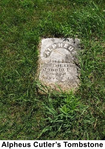
Christ of Latter-Day Saints" under their leader, Alpheus Cutler. Alpheus
claimed to have received a revelation that he should be Joseph Smith's
successor. Within a few years of Fisher's arrival, the settlement grew to
"thirty or forty families" (2), and its name changed to Manti after a city
and province found in the Book of Mormon (3). According
Mills County to develop the area. The settlement's distance from LDS
headquarters in Iowa attracted many disaffected "Mormons," who found enough
space to practice their beliefs as members of the "True Church of Jesus
Christ of Latter-Day Saints" under their leader, Alpheus Cutler. Alpheus
claimed to have received a revelation that he should be Joseph Smith's
successor. Within a few years of Fisher's arrival, the settlement grew to
"thirty or forty families" (2), and its name changed to Manti after a city
and province found in the Book of Mormon (3). According
 to Lew Weigand, "at one time there was probably five-hundred Cutlerites
(members of the True Church of Jesus Christ of Latter-Day Saints)" in the
area (4).
to Lew Weigand, "at one time there was probably five-hundred Cutlerites
(members of the True Church of Jesus Christ of Latter-Day Saints)" in the
area (4).
Reasons for Edmund Fisher's decision to settle in the Shenandoah Valley are unexplained, but Alpheus Cutler and the Cutlerites relocated to the area in hopes of further distancing themselves from The Church of Jesus Christ of Latter-Day Saints and its president, Brigham Young. Alpheus Cutler and his band of believers separated from Brigham Young and the majority of the Church because of polygamy while still adhering to other LDS practices. Another possible dividing factor, according to Lew Weigand, is that Alpheus Cutler had a different vision of what the Church ought to be doing. His idea was to go south and send missionaries to the Indians living in Kansas. Cutler also believed he would eventually drive the Missourians out of Independence and take over. Those who believed in this vision began to file into the area from 1853 to 1856 and included Edmund Fisher, Alpheus Cutler, Almond Whiting, Benjamin Mackentire, Lyman Murdock, Nicholas Taylor, William Badham, Pliny Fisher, Thaddeus Cutler, William Redfield, Ruben Oaks, Wheeler Baldwin, Clark Stillman, Jackson Burdick, Almon Sherman, Chauncey Whiting, Joseph Fletcher, Hiram Murdock, William Topham, Squire Eggleston, and H. F. Pratt (5).
Other settlers gradually came into the area and helped develop it into a
town with the necessary amenities of life, including a mill, church, school,
blacksmith shop, farms,
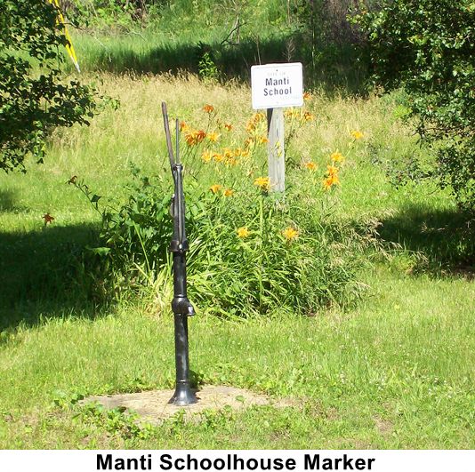 mail lines, and even a hotel. In 1853, the first schoolhouse was erected
and used until 1869; it was later used as a blacksmith shop operated by
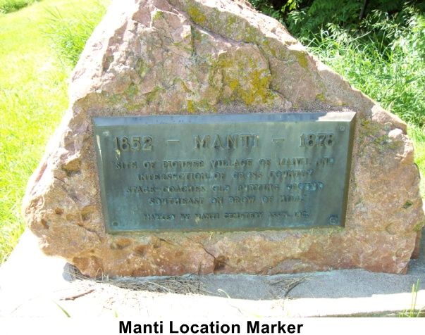
Curley Stokes. Just southeast of the schoolhouse, the town formed the Manti
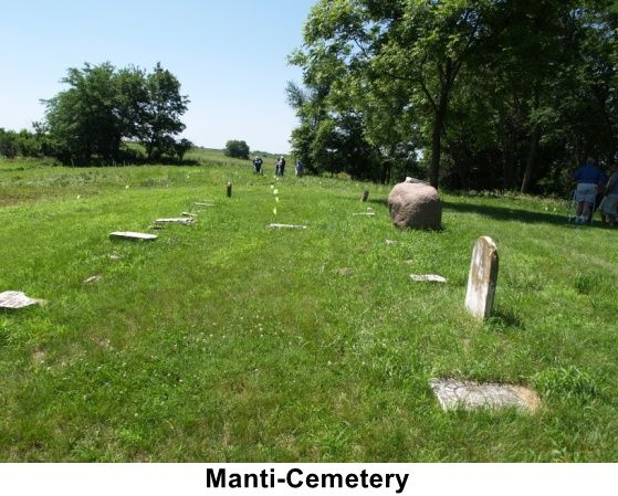
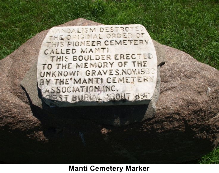
Cemetery, which is marked with a stone and bronze tablet. Later, Alpheus
Cutler assisted in the building of a church in 1854, and there the practices
of the Cutlerites began, initiating their formal separation from the
Brighamites (6). The Travelers Inn Hotel began operation in 1856 and
included space for stage-route horses and carriages under the direction of
William C. Matthews. Various stores and shops eventually served the town and
provided the goods needed for everyday life on the frontier.
mail lines, and even a hotel. In 1853, the first schoolhouse was erected
and used until 1869; it was later used as a blacksmith shop operated by
Curley Stokes. Just southeast of the schoolhouse, the town formed the Manti
Cemetery, which is marked with a stone and bronze tablet. Later, Alpheus
Cutler assisted in the building of a church in 1854, and there the practices
of the Cutlerites began, initiating their formal separation from the
Brighamites (6). The Travelers Inn Hotel began operation in 1856 and
included space for stage-route horses and carriages under the direction of
William C. Matthews. Various stores and shops eventually served the town and
provided the goods needed for everyday life on the frontier.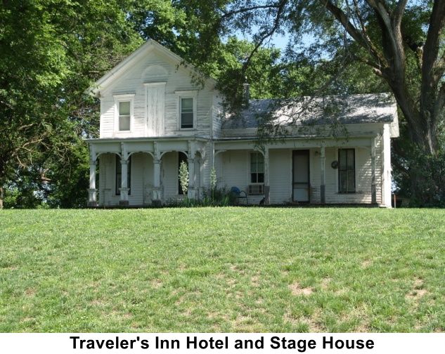
Under the direction of Alpheus Cutler, several settlers served missions to the American Indians in Grasshopper, Kansas, and "endeavored to set up a settlement among the Indians. The missionaries enjoyed meager success and eventually abandoned the mission to return to Manti (7). The fervent missionary work among the American Indians related to the call Alpheus believed he received from Joseph Smith Jr. prior to Smith's martyrdom in June 1844. Alpheus felt he had a mandate from Joseph Smith to preach the gospel to the Indians (8). Due to this undeterred belief, Alpheus refused to come west to Salt Lake City at the request of Brigham Young and the Quorum of the Twelve Apostles. He was excommunicated from The Church of Jesus Christ of Latter-day Saints on April 20, 1851. After this, many of the Silver Creek Branch members, the LDS branch over which Cutler presided at the time, "became followers of Cutler," forming the True Church of Jesus Christ of Latter-day Saints and helping to settle Manti (9).
Cutler and his followers refused to practice polygamy and trek west; thus,
the Cutlerite religion formed. The refusal to adhere to polygamy became
problematic for Alpheus and his family since he was a polygamist and had
seven wives himself. As a member of the Council of Fifty and with the
permission of his first wife, Lois Huntington Lathrop Cutler, he engaged in
the practice of polygamy. On January 14, 1846, he was sealed to Lois and
"Luana Hart Beebe on the same day. On 3 February 1846 he was sealed to five
more wives in temple ceremonies: Margaret Carr and her sister Abigail, Sally
Cox, Disey Caroline McCall, and Henrietta
 Clarinda Miller (10). Since the Cutlerites refused the practice of
polygamy, Alpheus renounced his plural marriages (11)".
Clarinda Miller (10). Since the Cutlerites refused the practice of
polygamy, Alpheus renounced his plural marriages (11)".
The later history of these individuals is unknown, with the exception of Luana Hart Beebe and Sally Cox. Luana "remained with the Cutlerites" for a time before leaving "to Utah", where she died "in 1897". Sally Cox also traveled to Utah and trekked with the "Ezra Taft Benson Company". Records indicate that she died in Salt Lake City in 1863 (12).
Two of Lois and Alpheus's children "went west with the main body of the church." William Lathrop Cutler and Louisa Elizabeth Cutler Rappleye lived and died in Utah with their respective families. Two of Alpheus's other children, Clarissa and Emily, married Heber Chase Kimball, a member of the Quorum of the Twelve Apostles, but they remained with their father when Kimball trekked westward to Utah and later "married Cutlerite men (13)". Before Clarissa and Emily separated from Heber, each had a son, Abraham and Isaac Kimball, respectively. Early in life, both sons lived in Alpheus's home but "reunited with their father in Utah during their early teens (14)".
Manti flourished through the mid-1860s, but upon the death of Alpheus Cutler, the town's future became uncertain. "Father Cutler," as his followers called him, died on June 10, 1864, but prior to his passing he told his followers "...of a land far to the north between two beautiful lakes, where they were to take a colony and preach to the Indians (15). Within a year, the Cutlerites discovered the prophesied land, and "the whole colony removed there and founded the village of Clitherall, Minnesota (16). With this dramatic drop in population and the railroad bypassing the town, Manti had diminished to cornfields by 1877 (17).
Shenandoah, a town founded in 1870 just five miles from Manti, received the railroad and rose to prominence while Manti diminished. Today, Shenandoah remains a town, while Manti is marked by a small park monument southeast of Shenandoah dedicated to the early settlers of the area.
Possible Burials in the Manti Cemetery
| Name | Birth Date | Death Date |
| Mary Eliza Redfield | 18 Dec 1848 | 14 Nov 1849 |
| Charles Muir | 22 Oct 1851 | 6 Jul 1852 |
| Theodore Whiting | 3 Jun 1853 | 6 Oct 1854 |
| Celestia Muir | 22 Aug 1855 | 1855 |
| Mary Porter | 20 Jul 1793 | 7 Jan 1855 |
| Lyman Edward Murdock | 15 Mar 1856 | 10 Sep 1856 |
| Judith Chambers Young | 1837 | 1857 |
| Infant Young (twin) | 1857 | 1857 |
| Infant Young (twin) | 1857 | 1857 |
| Jasper J. Peugh | Elisha Marks Peugh | 22 Dec 1857 |
| Lois Asenath Sherman | 5 Mar 1840 | 8 Mar 1858 |
| Triphena Sperry | 3 Sep 1858 | 1 Oct 1858 |
| Ethan Murdock | 10 Sep 1857 | 1859 |
| Edmond Hiram Pratt | 2 Aug 1858 | 29 Nov 1859 |
| Sarah Elizabeth Kelsey Murdock | 28 Apr 1832 | 13 May 1860 |
| Phiny Fisher | 5 Aug 1775 | 6 Aug 1860 |
| Sylvia Elizabeth Murdock | May 1860 | 18 Sep 1860 |
| Emma Caroline Mathews | 1 Jul 1860 | 28 Sep 1860 |
| James Muir | 25 Jun 1805 | 3 May 1862 |
| Alice Sperry | 1863 | 1863 |
| Lydia L. Pratt | 1856 | 15 Jan 1863 |
| Clarissa Anderson | 23 Apr 1859 | 3 Mar 1863 |
| Alpheus Cutler | 29 Feb 1784 | 10 Aug 1864 |
| Laura B. Harris | 1864 | 13 Mar 1865 |
| Ada Medora Anderson | 9 Apr 1865 | 23 Jun 1865 |
| Joseph I Anderson | 2 Jun 1863 | 13 Oct 1865 |
| Carrie Amelia Stearns | 1 Aug 1865 | 15 Dec 1866 |
| Joseph Henry Mathews | 10 Sep 1866 | 17 Apr 1867 |
| Mary Jane Fisher Pratt | 1837 | 21 Jun 1868 |
| Parley Eugene Stearns | 16 Mar 1869 | 16 Jul 1871 |
| Milner Grant Galt | 3 Nov 1868 | 29 Dec 1872 |
**Quotes from Lew Weigand were gathered on June 25, 2009 at the Manti Cemetery in Manti, Iowa. Lew Weigand was a recognized expert on Manti, Iowa who served as a local historical guide and authored scholarly research on related 19th-century religious movements.
Bibliography
1. Kershaw, W. L. History of Page County, Iowa (Chicago: S. J.
Publishing Co., 1909), 379.
2. Ibid.
3. Wilcox, Pearl.
Roots of the Reorganized Latter-Day Saints in Southern Iowa
(Independence, Missouri: P. G. Wilcox, 1989), 210.
4. Kershaw, W. L.
History of Page County, Iowa (Chicago: S. J. Publishing Co., 1909),
380.
5. Wilcox, Pearl.
Roots of the Reorganized Latter-Day Saints in Southern Iowa
(Independence, Missouri: P. G. Wilcox, 1989), 211.
6. Wilcox, Pearl.
Roots of the Reorganized Latter-Day Saints in Southern Iowa
(Independence, Missouri: P. G. Wilcox, 1989), 212.
7. Johnson, G.
Vaughn.
Alpheus Cutler: Temple Builder, Founder of Cutler's Park, Schismatic 3.
8. Ibid.
9. Johnson, G. Vaughn.
Alpheus Cutler: Temple Builder, Founder of Cutler's Park, Schismatic 3;
also found in Jorgenson, Danny L. The Old Fox: Alpheus Cutler,
Differing Visions: Dissenters in Mormon History. Roger D.
Launius and Linda Thatcher, eds., (Urbana: University of Illinois
Press), 162.
10. Ibid.
11. Ibid.
12.
Johnson, G. Vaughn.
Alpheus Cutler: Temple Builder, Founder of Cutler's Park, Schismatic,
3.
13. Johnson, G. Vaughn.
Alpheus Cutler: Temple Builder, Founder of Cutler's Park,
Schismatic 2.
14. Johnson, G. Vaughn.
Alpheus Cutler: Temple Builder, Founder of Cutler's Park,
Schismatic 2; also found in Jorgenson, Danny L. The Old Fox:
Alpheus Cutler,
Differing Visions: Dissenters in Mormon History. Roger D.
Launius and Linda Thatcher, eds., (Urbana: University of Illinois
Press), 162.
15. Wilcox, Pearl.
Roots of the Reorganized Latter-Day Saints in Southern Iowa
(Independence, Missouri: P. G. Wilcox, 1989), 212.
16. Davis, Inez
Smith. The Story of the Church; also found in Johnson, G. Vaughn.
Alpheus Cutler: Temple Builder, Founder of Cutler's Park, Schismatic, 3.
17. Wilcox, Pearl.
Roots of the Reorganized Latter-Day Saints in Southern Iowa
(Independence, Missouri: P. G. Wilcox, 1989), 216-217.
View list of community residents
McKissick Grove, Fremont County, Iowa
Location
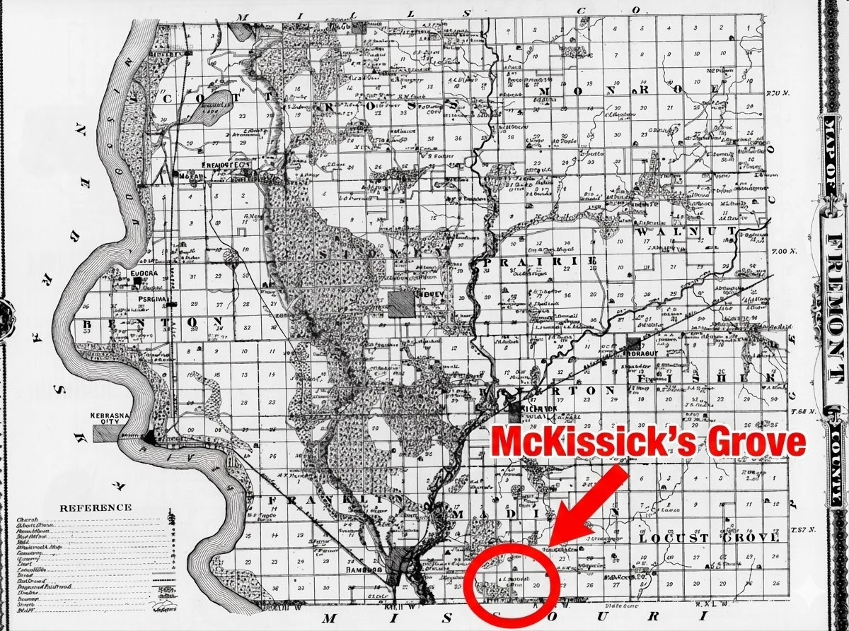
McKissick Grove is located in southwest Madison Township, Fremont County, Iowa, three miles east of Hamburg.
The 1875 map of Fremont County shows the location.
History
McKissick Grove, also known as McKissick's Grove, is described as "an LDS encampment," although the settlement was not founded by Latter-day Saints (1). Long before there was a Mormon presence in the region, Cornelius Washington McKissick and his wife, Hannah, left Clay County Missouri to start a new life in the wilderness. He built his house and farm in what would become McKissick Grove in 1840 and planted the first orchard in Fremont County (2). By the end of that year, his two brothers, Jacob and John, had joined them, along with David M. English and his family.
In 1841, more McKissick siblings came to the Grove. Daniel and William Kent McKissick and their sister, Jane Ann Fletcher, and her husband, Moses Fletcher, moved to McKissick Grove. James Cornelius and Thomas Farmer also arrived during this year (3).
When the Mormons came to the Middle Missouri Valley in 1846, some settled in the already established McKissick Grove. James L Thompson and Clark and Dexter Stillman, who marched with the Mormon Battalion, were some of those that settled there. James L Thompson left for the Salt Lake Valley in the Isaac Bullock Company in 1852, and the Stillman brothers ended up joining the Cutlerites (4).
In 1844, a stagecoach route was added from St. Joseph, Missouri to Council bluffs, Iowa, which passed just south of Cornelius McKissick's property. Thomas Farmer built a stage station there, and a post office was added to that building. His son-in-law, JT Davis, built on to the station and added a store.
The first term of the District Court was held in 1850 by Judge William McKay in a log cabin at McKissick Grove (5).
Jacob McKissick ran a lumber mill and a meat packing plant there in the Grove for some time. The meat packing plant failed because the heat of the summer months would make the meat go bad too quickly. He was also the Postmaster. The post office in McKissick Grove lasted from 1851-1869.
In 1851, there was a man by the name of Benjamin Rector from Fremont County who declared that the citizens of that county would not uphold a Mormon judge, if one were to be elected. In response to this, many citizens of Fremont County who did not agree with this statement wrote a letter to the citizens of Pottawattamie County, explaining that Mr. Rector was not authorized to make that claim on behalf on the whole county, and that they would, in fact, uphold the appointment of a Mormon judge, if one were to be elected. Many prominent men from McKissick Grove signed this letter, including Jacob, Cornelius, and Daniel McKissick, as well as Thomas Farmer and David M English (6).
In 1851, a directory containing the name, post office, county and state of every lawyer in the United States listed two men under the McKissick Grove Post Office, Christopher P. Brown and Emanuel S. Jones (7). Mr. Brown is also mentioned as a candidate for the judgeship of the Sixth Judicial District in Iowa (8).
In 1861, William McKissick led a wagon company through Salt Lake City to California. Most of the Company were non-Mormons but some were, in fact, Mormons. However, the train did not depart from McKissick Grove; therefore, we cannot know for sure whether or not those in the train were from McKissick Grove.
Cemetery
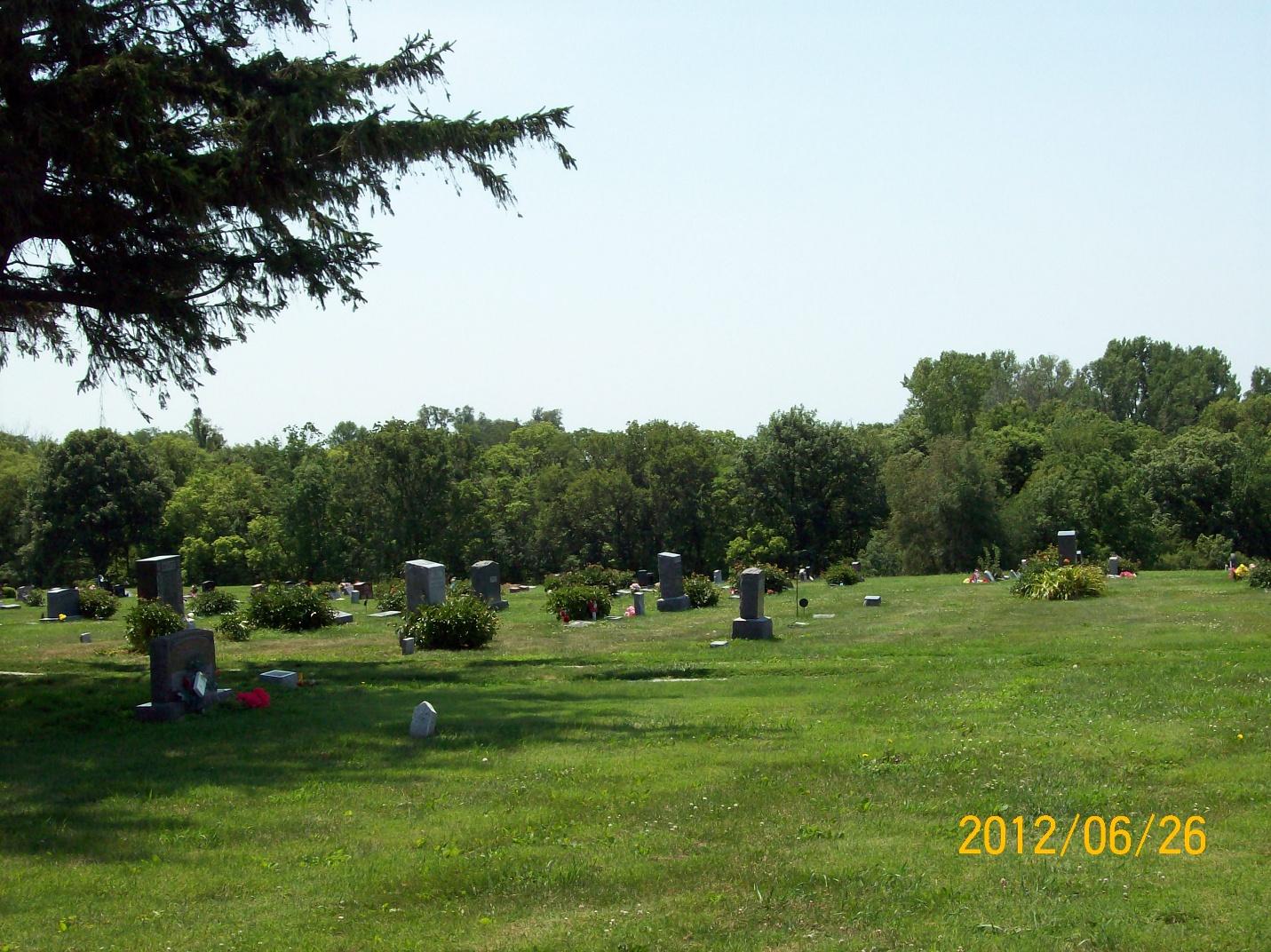
The Mount Olive Cemetery is the closest local cemetery. Many of those who lived in McKissick Grove, including many original settlers, are buried there. It was originally called McKissick's Cemetery, then Farmer's Cemetery (Thomas Farmer owned the land it was on), and finally Mt. Olive Cemetery. Alva Calkins and his family are buried in this cemetery. Alva served in the Mormon Battalion and afterwards came back to Iowa. However, it appears by all accounts that they resided in Hamburg, not McKissick Grove, despite the location of his resting place.
Possible Burials
| Name | Birth Date | Death Date |
| Sampson Bethard | 27 Jan 1846 | |
| Moses Reel | 1802 | 1847 |
| James Reel | 1832 | 3 Feb 1847 |
| James Parman | 30 Apr 1815 | 25 Sep 1847 |
| Henry Watts | 14 Nov 1814 | Jun 1849 |
| Amanda McKissick | 9 Jun 1849 | 20 Oct 1849 |
| Sampson Bethard | 1846 | Mar 1850 |
| Caleb English | 31 Aug 1851 | 7 Oct 1851 |
| David Moore English | 4 Mar 1819 | 8 Jan 1852 |
| Robert Davis | 1853 | 1853 |
| Lucinda Davis | 1854 | 1854 |
| Marinda Davis | 1854 | 1854 |
| Male McKissick | 1860 | 25 May 1860 |
| Cynthia U. Farmer Imhoff | 1842 | 18 Sep 1860 |
| John W. Allen | 14 Jul 1819 | 11 Oct 1862 |
| Lucinda A. Parman | 24 Apr 1837 | 14 Nov 1862 |
| Henry C. Fugitt | 1 Apr 1850 | 23 Jun 1866 |
| Hiram Fugitt | 9 Apr 1794 | 2 Feb 1873 |
| Sarah Farmer Booton | 22 Dec 1853 | 26 Mar 1877 |
| Caroline Kimes Farmer | 24 Jul 1846 | 13 Feb 1886 |
| Townsend Fugate Fugitt | 1 Feb 1824 | 21 Mar 1888 |
| Nancy Comstock Parman | 30 Apr 1819 | May 1890 |
| Nancy A. Fugitt | 1848 | 25 Oct 1891 |
| Cornelius Washington McKissick | 19 Aug 1816 | 27 Mar 1893 |
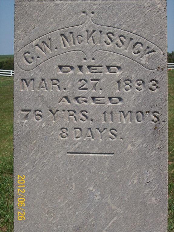
Bibliography
- Susan Easton Black, accompanying CD to The Best of the Frontier Guardian (Salt Lake City: University of Utah Press, 2009).
- John Gregg, Standard Historical Atlas of Mills & Fremont County, Anderson Publishing Company.
- Benjamin F. Gue, History of Iowa: From the Earliest Times to the Beginning of the Twentieth Century (New York: The Century History Co., 1903), 348.
- Susan Easton Black, accompanying CD to The Best of the Frontier Guardian, (Salt Lake City: University of Utah Press, 2009).
- Benjamin F. Gue, History of Iowa: From the Earliest Times to the Beginning of the Twentieth Century (New York: The Century History Co., 1903), 3
- "To the Citizens of Pottawattamie County," The Frontier Guardian, April 3, 1851.
- John Livingston, Livingston's Law Register: The Name, Post Office, County and State of Every Lawyer in the United States (New York: office of the Monthly Law Magazine, 1851), 59.
- Susan Easton Black, accompanying CD to The Best of the Frontier Guardian, (Salt Lake City: University of Utah Press, 2009).
View list of community residents
Green Hollow/Dutch Hollow, Fremont County, Iowa
Location
A hollow is a valley on the west face of high loess bluff system. The valley provided residents protection from weather and a refuge. It offered timber of all kinds of wood and a place where wild fruit and bluegrass grew.Green Hollow is located 3 miles north of Thurman on Plum Creek and Osage Road. It was named by the granddaughter of the first white female child born in Scott township. Mary Elizabeth Forney when she announced to her family that the lost family cow was over in the pretty green hollow. Those families known to inhabited that area were George Washington and Emma Forney, William and Maggie Pierce, and John Oliver Keran They lived at the mouth of the hollow. Others in the hollow were Ezra Study and Ira and Bertha Clapper.
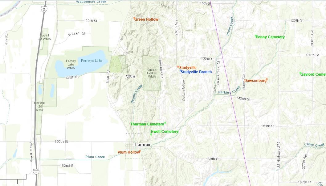
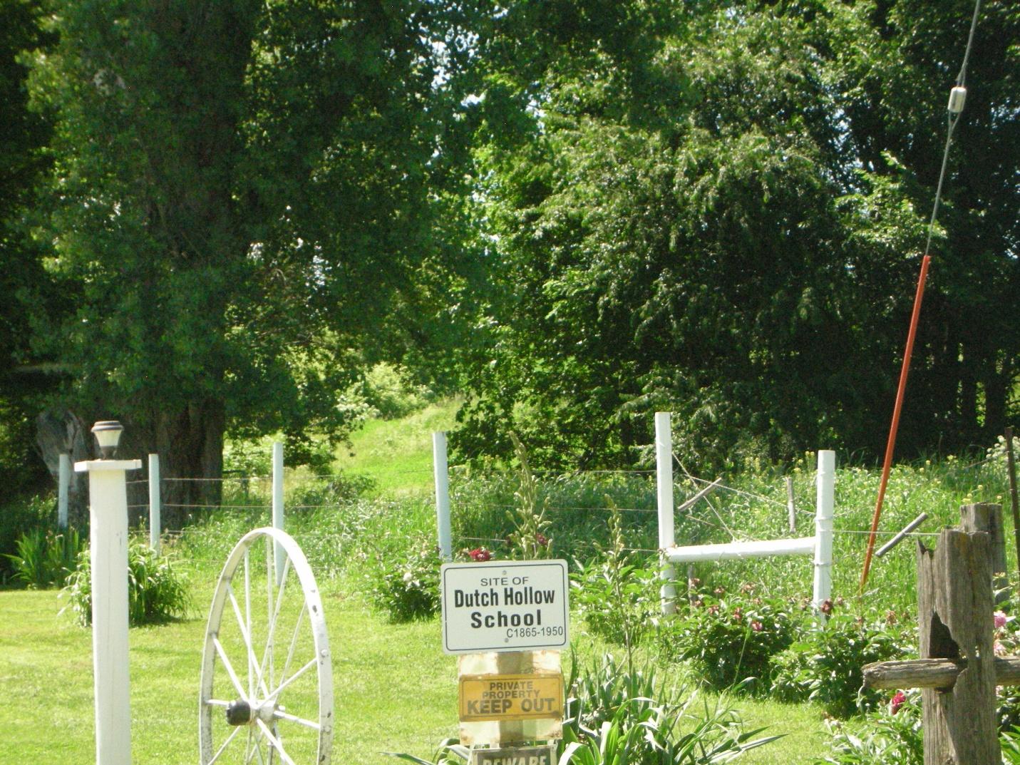
Dutch Hollow is located to the east of Green Hollow. This is the site of the Dutch Hollow school.
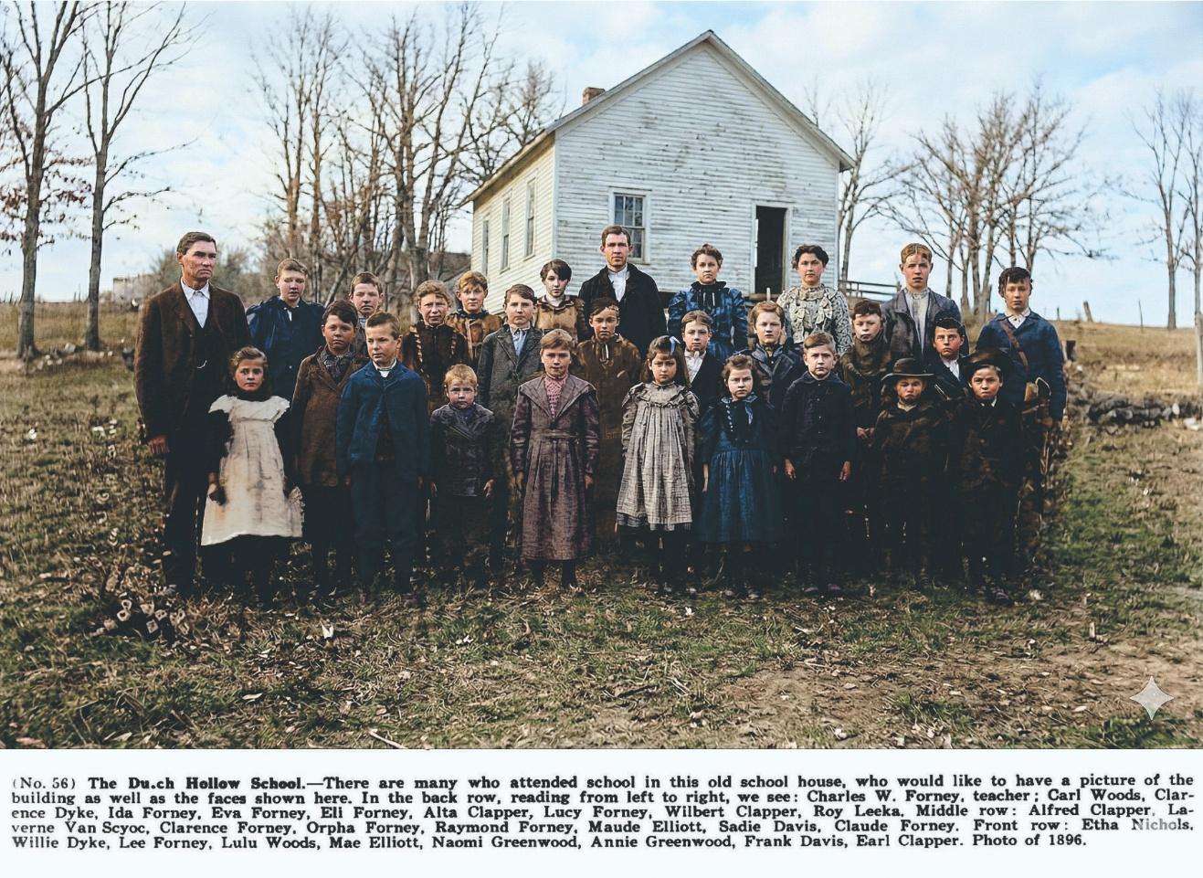
Students of the Dutch Hollow school.
Location
At the time of its settlement, Plum Hollow was located ten miles northwest of Sidney in the present-day Scott Township at the foot of the Missouri Rive bluff on Plum Creek (1). The map illustrates its approximate location (2).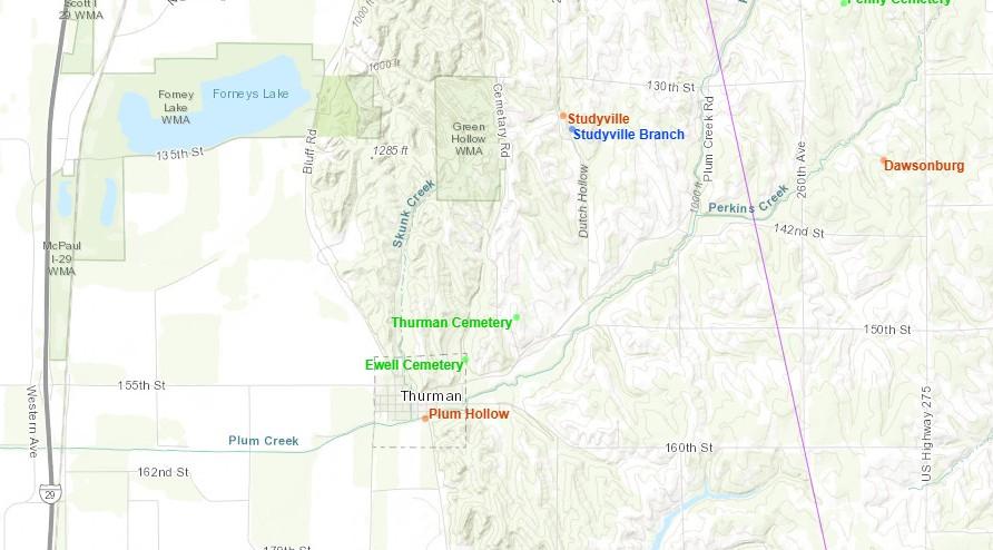
History
One of the earliest LDS settlements in the Middle Missouri valley, Plum Hollow grew slowly, eventually being incorporated as a village 33 years after its initial settlement (3). It is also possible that the original Plum Hollow settlement and several family settlements in Dutch Hollow to the north were made by the same families. The general area was originally settled by the Study, Forney, Clapper and Ettleman families.Abraham Fletcher is often incorrectly credited as the man who created Plum Hollow in 1856, building his residence, opening probably the first store, and serving as the first postmaster. Yet Fletcher had lived in Plum Hollow since 1851, so he could not have been the original founder. It is more likely that Fletcher revitalized the settlement as it was slowly being abandoned by its original inhabitants. He changed the name to Fremont City, seeking to begin anew (4). Eventually, though, even Fletcher would be forgotten, and the village would become known as Thurman (5). Over time, the original settlers of Plum Hollow came to be associated only with the settlements of Dutch Hollow, obscuring the common history of both settlements.
The most influential people in the early days of the Plum Hollow settlement area were without question the Study family. The Studys represented a foundational center for the early settlers, many of whom had married into the family or were related by previous marriages. These were mostly concentrated around two brothers, John and David C. Study. John Study never actually lived in Iowa. His wife and children, however, would have a lasting impact on Plum Hollow and Dutch Hollow, while David C. Study took his brother's place at least as the symbolic head of the family.
John married Barbara Benner sometime prior to 1821, when their first child, Catherine Study, was born in Ohio. Their fourth child, Leonard Study, recounts in his personal history that the family moved to Missouri sometime in 1834-1835. Though they barely mention it, the Studys endured difficult circumstances in Missouri. Harsh treatment by Mormon-intolerant mobs drove the family from their new home in 1835. John later signed an affidavit in appeal to Congress for losses of $1500 (6). Fortunately, the Studys were able to escape to the town of Quincy in Adams County, Illinois, and after a year they moved to Nauvoo, Illinois (7). Having reached Nauvoo and safety at last, the Study family settled into their new home. The two oldest daughters, Catherine and Elizabeth, were married during this time, Catherine to George Forney in 1840 and Elizabeth to John Martin Ewell in 1842. The family's greatest trials began on March 1, 1843, when John Study passed away. The murder of the Prophet Joseph Smith little more than a year later plunged the Studys, and all of Nauvoo, back into the flickering torch-light of mob scrutiny. The future of the family was once again tenuous.
Christopher Study's second son, David C. Study, came to the aid of his brother's family, taking Barbara and her children into his home. Barbara had an older sister, Mary Benner, who herself shared in their grief, having lost her own husband just two years earlier (8). Taking care of his brother's family, David naturally came into contact with Mary, and the two were eventually married.
Exactly when in 1846 the rest of the family moved to what is now Plum Hollow is not known, but the original settlers are listed in an 1881 History of Fremont County, "among them D. C. Study, Barbara Study, George Forney, Mrs. John M. Ewell and Mary Ann Dike" (9). On October 19, 1846, a son, George Washington Forney, was born to Catherine and George Forney, and the first marriage in Fremont County took place a year later, on October 10, 1847, between Samuel Ettleman and Susan Forney. The settlement was strong enough to support these and other events, and soon other family members and friends began arriving in Plum Hollow.
The land claims of the Studys and many of their relatives were solidified and formalized on April 11, 1847, when Congress passed the first of four acts "granting over sixty million acres of public lands to more than a half-million veterans, widows, and heirs" (10), an act which encompassed the budding settlement in Fremont County. Probably the family members that participated in the Mormon Battalion did not specify the location of their land claims until they returned to Iowa, thereafter, claiming land near Plum Hollow. But John Study, a son of David C. Study and his first wife, had been a Private in Captain Moses' Company D of the first regiment of Illinois volunteers during the Civil War (11). He evidently lost his life before reuniting with this family, and in lieu of his son's death, Mr. Study was given a land warrant which claimed a small piece of land in section 30 of Ross Township. As David C. Study was the head of the family, his plot of land in section 30 can be considered the center of the settlement.
The first settlers closest to what would someday become Plum Hollow central were John Martin Ewell and his wife, Elizabeth Study Ewell. John returned from his service in the Mormon Battalion in the autumn of 1847 and purchased land first in Section 6 of Sidney Township, then bought more land closer to Plum Hollow, in Section 36 of Scott Township, bringing his land possessions to about 200 acres. Little is known about Plum Hollow's early administration, but John Ewell's respectable land holdings, military service, and family connections certainly made him an important figure in the emerging community.
More important and influential in Plum Hollow than the Ewells, however, was Abraham Fletcher, as he distinguished the settlement from the Study family. Fletcher arrived in Plum Hollow in 1851 (12). He is sometimes credited with founding the settlement, but the Studys had obviously arrived much earlier. Fletcher revitalized Plum Hollow, owing to the Study's lack of interest in concentrating their settlements. Fletcher created the first town center, building "the first residence, [opening] the first store, and [becoming] the first postmaster" (13). Fletcher also renamed the community Fremont City, an attempt to exhibit the community as Fremont County's best and greatest. It was later discovered that Fremont City already existed, so the name was changed to Thurman (14).
Two years after Fletcher's attempt to revitalize Plum Hollow, his wife. Rebecca, died. Having lost a large part of his vision, Fletcher despaired, explaining why the town was not incorporated until 1879 (15). Fletcher would eventually marry again, though this second marriage, like that of Christian Clapper and Margaret Ettleman, was seen as one of convenience. In 1860, Abraham married Sarah Ann Farley, and during their years together they had one son, Grant. The 1880 Census shows Sarah Fletcher was a patient at the Iowa Hospital for the Insane, probably the Mental Health Institute in Mount Pleasant, Henry County. She remained in the hospital for an indeterminate amount of time, during which Abraham lived with Sarah's daughter, Almira. Fletcher died in Thurman in 1891 and is buried in Thurman Cemetery alongside twelve of his family members.
By 1856 a clear distinction existed between Plum Hollow and Studyville. But before this time came, other family settlements began to spring up. The Clappers built their own Clapperville on land very close to the Studys, while Simon Dyke and his family intermittently inhabited the Dyke Settlement. These other family settlements serve to confuse the history of Plum Hollow and Studyville, though they specifically belong in the Dutch Hollow group of settlements with Studyville, their ties being to David C. Study and Barbara Study.
Cemeteries
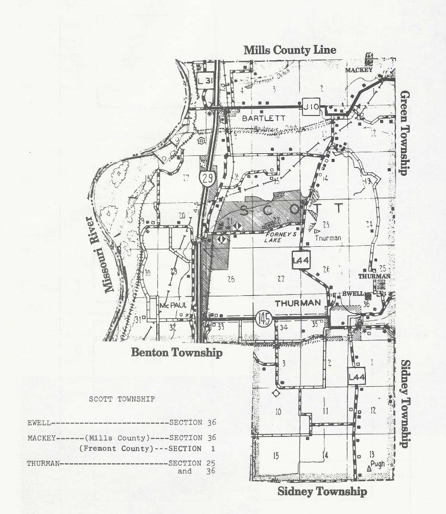
A later map shows the Scott township and the position of the Ewell Cemetery and the Thurman Cemetery (16).
Ewell Cemetery
The Ewell Cemetery is a small family cemetery near the Thurman Cemetery but is a separate graveyard. John Ewell requested that he be buried on a certain spot on his farm, north and west of his home on the brow of a hill, overlooking his farm and home. Elizabeth Ewell was laid to rest by the side of her husband (17).
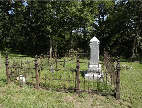
In 1852, John and Elizabeth lost their nine-day old daughter, Barbara. She was buried on a portion of John's property. Ewell Cemetery, as the little grave came to be known, was actually the beginning of today's Thurman Cemetery and the Ewell addition. Other families who marked out their own private plots in the cemetery were the Forneys, Schooleys, Greenwoods, Baylors and Leekas (18). Before John died in 1893, he asked to be buried on the same plot, and to this day Ewell Cemetery is revered family ground.
Thurman Cemetery
The Thurman Cemetery is located high on a bluff east of the Plum Hollow settlement which is now known as Thurman. In the beginning it was located on the Ewell farm. As other people gave land to the cemetery, each became known by the donor's name. Other areas were added by the Forney, Schooley, Greenwood, Baylor and Leeka.
Possible Deaths
| Name | Birth Date | Death Date |
| Barbara Ann Ewell | 1 Feb 1852 | 10 Feb 1852 |
| David W. Fletcher | 23 Aug 1832 | 21 Jan 1856 |
| Rebecca Crouch Fletcher | 27 Jul 1801 | 19 Jan 1858 |
Bibliography
- Wilcox, Pearl, Roots of the Reorganized Latter Day Saints in Southern Iowa. Pearl Wilcox, Independence, Missouri, 1989, 112.
- Plewe, Brandon, Mormon Places: https://mormonplaces.byu.edu/map.html?id=481327 (accessed September 7, 2025)
- History of Fremont County, Iowa (Des Moines, IA: Iowa Historical Company, 1881), 611.
- Ibid.
- Charles William Forney, Forney's Five Family Records of Genealogy of Benners, Clappers, Ettlemans, Forneys and Studys (Boone, IA: Standard Printing Company, 1931), 146.
- Clark V. Johnson, Mormon Redress Petitions: Documents of the 1833-1838 Missouri Conflict (Provo, UT: Religious Studies Center, Brigham Young University, 1992), 360. A David Study is also listed as a petitioner in The Appeal en Masse, page 596.
- Ibid. , 336. 338.
- Charles William Forney, Forney's Five Family Records of Genealogy of Benners, Clappers, Ettlemans, Forneys and Studys (Boone, IA:: Standard Printing Company, 1931), 131.
- History of Fremont County, Iowa (Des Moines, IA: Iowa Historical Company, 1881), 611.
- James W. Oberly, Sixty Million Acres: American Veterans and the Public Lands Before the Civil War (Kent, OH: The Kent State Press, 1990), 3.
- U.S. Department of the Interior Bureau of Land Management General Land Office Records, "Land Patent Record, David C. Study," http://www.glorecords.blm.gov/results/default.aspx?searchCriteria=type=patent|st=IA|cty=071|ln=study|fn=david|sp=true|sw=true|sadv=false (accessed September 11, 2025).
- Fremont County Historical Society, Fremont County, Iowa, Cemetery Records (Marceline, MO: Walsworth Publishing Company, Inc., 1983), 159.
- Ibid. , 159.
- Ibid. , 159.
- Ibid., 611.
- The Fremont County Historical Society, Fremont County, Iowa, Cemetery Records (Walsworth Publishing Company, Inc., 1983), 156.
- The Fremont County Historical Society, 157.
- Ibid., 159.
View list of community residents
History of Studyville, Fremont County, Iowa
Location
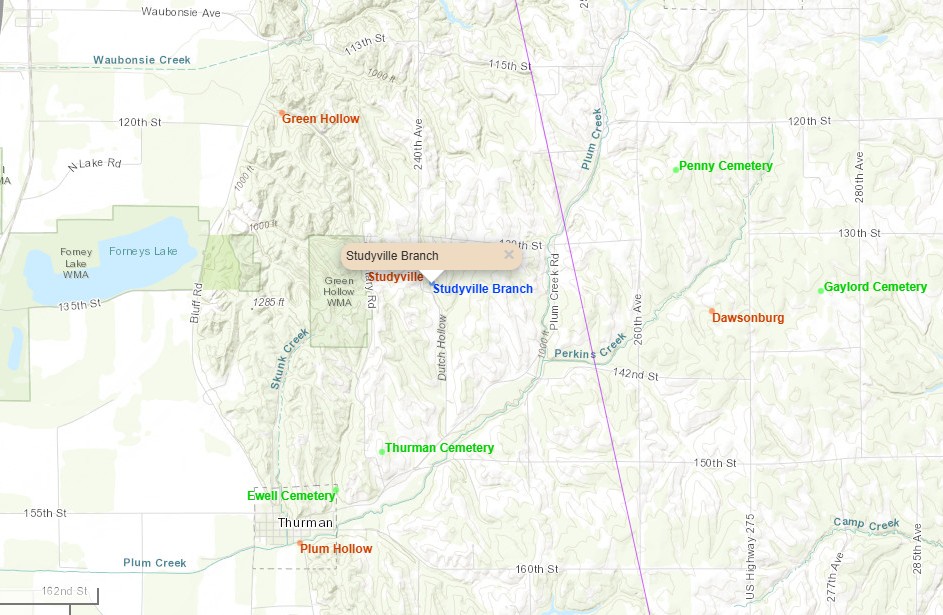
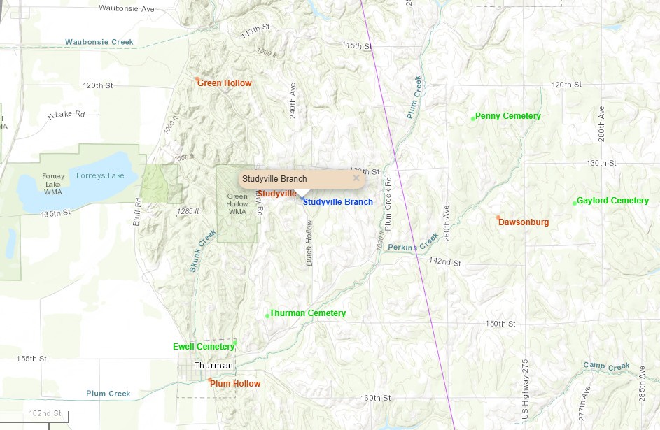
David C. Study built his new home in Dutch Hollow or Green Hollow. Dutch Hollow and Green Hollow, as seen on the map. They are larger areas of land and not specific settlements. There were two David C. Study families. They were living next to each other on the 1850 U. S. Census. David C. Study, born 1795, was first married to Elizabeth “Betsey” Griffin. They had eight children. She died in about 1850 in Illinois. He then married Mary Margaret Benner when he came to Fremont County in 1850. She was the widow of Johann Karl Forney. They had ten children. Some of her children were living with them as indicated by the 1850 Census record. David C. Study died in 1872 in Thurman, Fremont County and is buried in the Thurman Cemetery. The other David C. Study is a nephew of the previous David. C. Study. He was born in 1826 and married Mary Ann Ettleman in 1849. The Study family members began to call their home Studyville.
Privates Frederick Forney, John Huston, John Martin Ewell, David C. Study and Simon Dyke were discharged from the Mormon Battalion on July 16, 1847, and they immediately began their trek home to Iowa. Travelling together in a loosely bound company, they walked home by way of Fort Sutter, leaving on August 25 or 26 and arriving in Iowa in October, perhaps just in time for the wedding of Samuel Ettleman and Susan Forney (2). A great friendship had already existed between David C. Study (1826) and the Ettlemans, and he and lifelong friend Mary Ann Ettleman were themselves married on June 28, 1849. Forney's Five relates that David built his home in Dutch Hollow or Green Hollow shortly after his marriage, eventually including an orchard with apple and peach trees (3). It is significant that David built his new home specifically in Dutch Hollow or Green Hollow, rather than Plum Hollow. It appears that by this time the founding families of Plum Hollow had distanced themselves from establishing a viable settlement, instead of being content to live in vague family-named settlements. He and the other Study family members began to call their home Studyville
This is a picture of where Studyville was located.
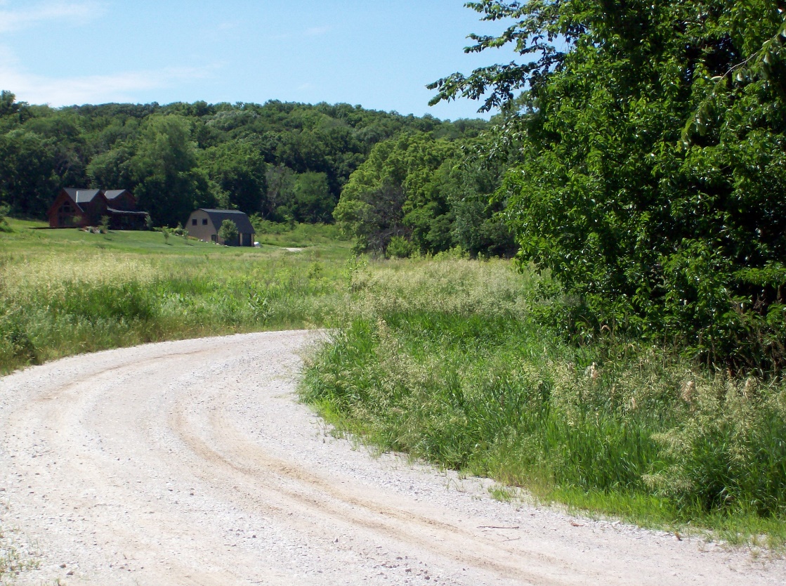
There was a Branch of the Church of Jesus Christ of Latter-day Saints at Studyville. David C. Study was listed as a High Priest on the Pottawattamie High Priest Quorum minutes (4).
There was a school located somewhere along the Dutch Hollow. Below is a picture of that location.
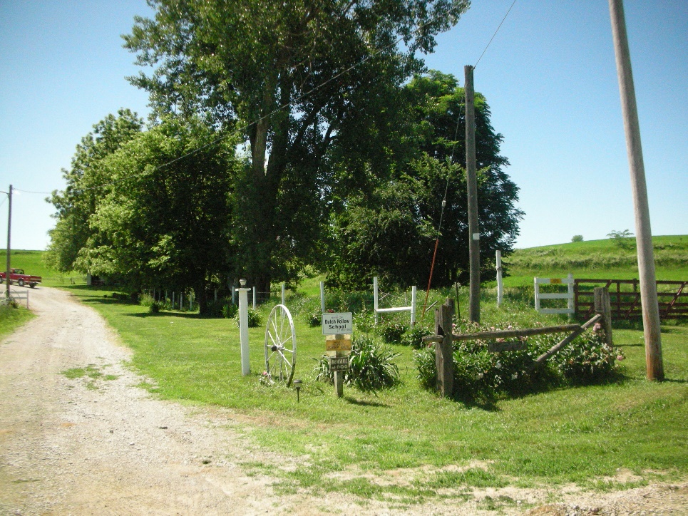
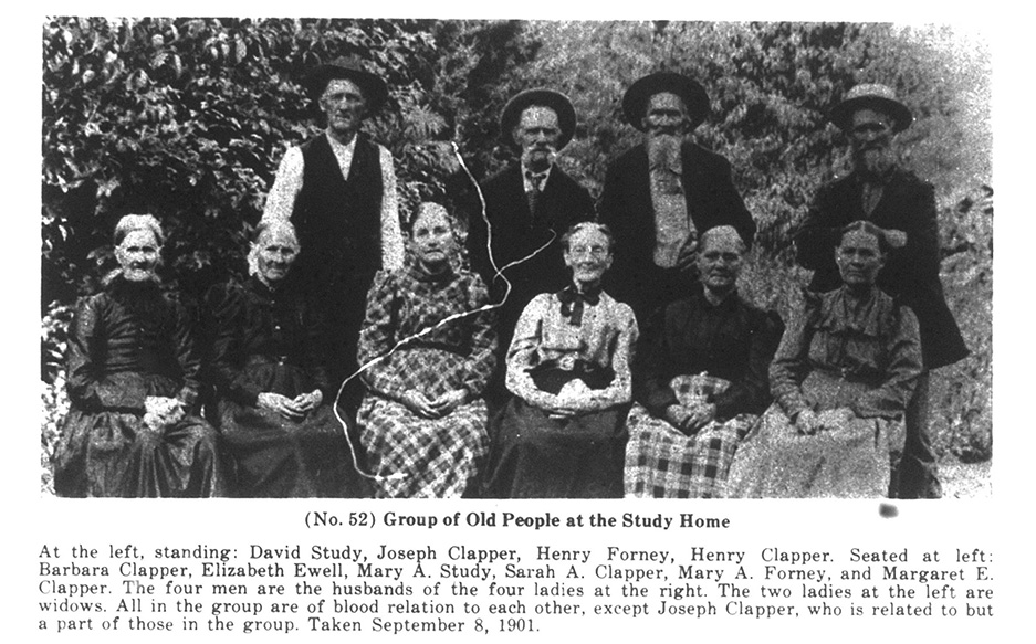 A picture was taken at the Study home (5).
By 1856, a clear distinction existed between Plum Hollow and Studyville. But before this time came, other family settlements began to spring up. The Clappers built their own Clapperville on land very close to the Studys, while Simon Dyke and his family intermittently inhabited the Dyke Settlement. These other family settlements serve to confuse the history of Plum Hollow and Studyville, though they specifically belong in the Dutch Hollow or Green Hollow group of settlements with Studyville.
Cemeteries
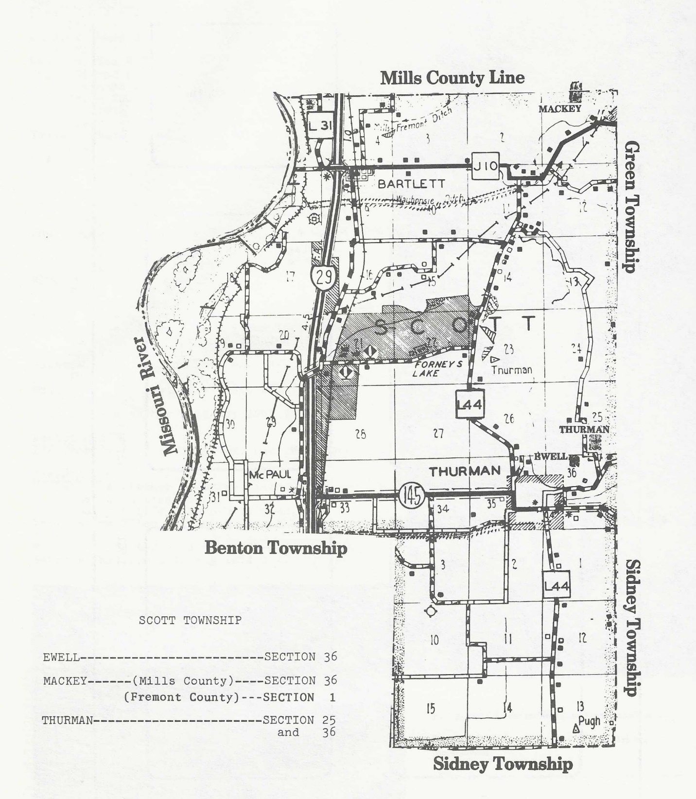
Ewell Cemetery
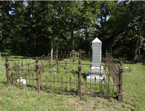
Possible Burials
| Name | Birth Date | Death Date |
|---|---|---|
| John Martin Ewell | 5 Aug 1823 | 1 Oct 1893 |
| Thomas Maxey Ewell | 6 May 1819 | 10 Jan 1900 |
| Elizabeth Study Ewell | 18 Jan 1824 | 29 May 1906 |
| John Martin Ewell, Jr. | 27 Aug 1845 | 22 Oct 1933 |
Plum Hollow/Thurman Cemetery
The Thurman Cemetery is located high on a bluff east of the Plum Hollow settlement which is now known as Thurman. In the beginning it was located on the Ewell farm. As other people gave land to the cemetery, each became known by the donor's name. Other areas were added by the Forney, Schooley, Greenwood, Baylor and Leeka families.
Bibliography
- Plewe, Brandon, Mormon Places: https://mormonplaces.byu.edu/data/entities/481251 (accessed August 20, 2025)
- Charles William Forney, Forney's Five Family Records of Genealogy of Benners, Clappers, Ettlemans, Forneys and Studys (Boone, IA: Standard Printing Company, 1931), 330.
- Forney, 333.
- Pottawattamie High Priests Quorum. Pottawattamie High Priests Quorum minutes , https://catalog.churchofjesuschrist.org/record/166b5a84-3e69-40f5-9774-1049977096a9/0?view=browse&lang=eng (accessed: August 31, 2025)
- Forney, 334.
- The Fremont County Historical Society, Fremont County, Iowa, Cemetery Records (Walsworth Publishing Company, Inc., 1983), 156.
- The Fremont County Historical Society, 157.
View list of community residents
Clapperville, Fremont County, Iowa
Location
Clapperville was located near the settlement of Studyville. There were probably only a few cabins that the family established in Dutch Hollow.
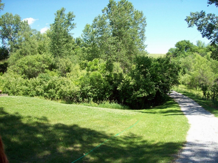
A photo was taken of the area that was known as Clapperville.
History
The Clapper history traces back to Germany. As they emigrated to the United States, they were classified as Pennsylvania Dutch. The earliest Clapper to emigrate from Germany was Mathias Clapper who was married to Mary King. Mathias died in Stark County, Ohio. Mary died in Hancock County, Illinois. The Clappers intermarried into the Benner, Ettleman, Forney, and Study families.
The children of Mathias and Mary Clapper, Christian, Jacob, and Christena all lived at one point in Dutch Hollow, specifically in Clapperville. Their sister, Elisabeth, first married Jacob Smith. He died in Stark County, Ohio before 1843 when Elisabeth next married Pleasant Walter Ewell. Elisabeth did not follow Pleasant to Utah. She died at the home of her daughter, Margaret, who married Jacob Forney, in Hancock County, Illinois. She and Pleasant may have lived in Clapperville or Studyville.
Catherine Clapper, another sister, married Philip Ettleman. They may have lived in Clapperville or in Studyville. They left with the Joel Edmunds Company in 1852 for the Salt Lake Valley. Philip died in Box Elder County, Utah in 1854. Catherine returned to Fremont County where she died in 1888.
Christena Clapper married Henry Ettleman. Henry was the brother of Philip Ettleman. Thus, sisters married brothers. Henry was Company Captain of the 1853 Ettleman Company that arrived at Salt Lake City on 1 October 1853. The following were part of that Company:
Christena Clapper Ettleman
Christian Clapper
Elisabeth Clapper Hendrickson
George Ettleman
Henry Clapper
Joseph Clapper
Lucy Ann Clapper
Margaret Smith Clapper Ettleman
Mary Ann Clapper Hitchcock
Mary Ellen Clapper
Mary Ellen Ettleman
Moroni Hiram Ettleman
Sarah Ann Ettleman Clapper
Susan Ettleman
Susann Clapper Davis
The 1860 U. S. Census shows that Henry and Christena had moved back to Iowa where they died in 1865 and 1881, respectively.
Jacob Clapper married Barbara Forney in 1832. They moved to Stark County, Ohio where they joined the Church of Jesus Christ of Latter-day Saints. They followed the Saints to Missouri and then went to Hancock County, Illinois. They crossed Iowa and arrived near Kanesville about July 2, 1846. Subsequently they built a humble home in Dutch Hollow which became known as Clapperville where they stayed until their death.
Christian Clapper first married Catherine Miller. Catherine died at the age of 49 years near Egypt settlement in Mills County, Iowa. They had two children.
Christian married a second time to Margaret Ettleman who was the widow of Jacob Ettleman, Sr. Her maiden name was Smith. Both parties had recently lost their companions, and each had a family of small children dependent on them. No children were born to this union.
Christian and Margaret traveled to the Salt Lake Valley in the Hennry Ettleman Company in 1853. While in Box Elder County, Christian married Susan Ettleman who was the daughter of Jacob Ettleman, Sr. and Margaret Smith. Strangely, Christian left Utah with his family sometime between the birth of Susan’s second child in 1859 and 1860, as Christian and his family are found in Plum Hollow in the 1860 U. S. Census. Word of their younger brother’s success in Iowa reached Christian and Christena, and their desires for stronger family and financial safety and may have been a deciding factor in their return to Clapperville (1).
Bibliography
- Charles William Forney, Forney’s Five Family Records of Genealogy of Benners, Clappers, Ettlemans, Forneys and Studys (Boone, IA: Standard Printing Company, 1931), 25.
View list of community residents
Dike Settlement, Fremont County, Iowa
Location
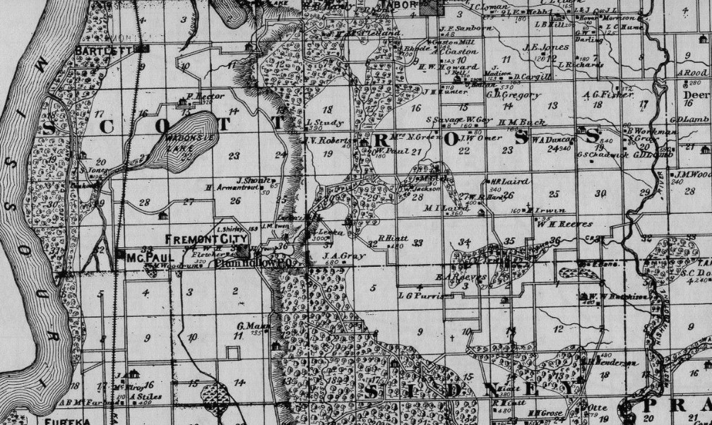
Dike Settlement is difficult to pinpoint, but according to the 1850 Census and existing GLO records, Simon Dike’s early property was located in section 19 of modern-day Ross Township (1). This area is scarcely separate from Studyville and is probably only distinguished from the Study settlement because of Dike’s ties to Strangism.
History
Simon Dike enlisted in the Mormon Battalion in 1846. He served as a Private in Company E. He returned to Iowa with Frederick Forney, John Huston, John Martin Ewell, and David Study in 1847.
Simon had married Mary Ann Forney while living in Nauvoo, Hancock County, Illinois in 1842. Mary Ann was the daughter of Johann Karl Forney and Mary Margaret Benner. Simon and Mary Ann were the only known inhabitants of the Dike Settlement. Their stay in the settlement was short. Two children were born to them in 1849 and 1851 there. In 1856, however, Joseph James Dike was born in Troy, on Beaver Island in Michigan far from the established Dike home and relatives. Simon and his family apparently lived for a time among James J. Strang’s Strangite sect, which had shifted their gathering from Voree, Wisconsin to Beaver Island, Michigan in 1850. Simon and his family returned to Iowa probably following the assassination of James Strang in 1856 (2).
Strangite missionary activity in the Missouri River area was extant almost immediately after the Camp of Israel arrived. Their claim that James Strang was the rightful successor to the Prophet Joseph Smith restricted their missionary efforts mostly to converting baptized LDS members, and relatives to their numbers. Their presence in the Iowa area was strong. Strangite missionaries Uriah C. Nickerson, John Shippy, and Benjamin Wright all served in Harrison, Pottawattamie, Mills, and Fremont Counties for several years.
In 1859, a daughter, Mary Jane, was born northeast of Thurman, possibly in the Dike Settlement. Another child was born northeast of Thurman in 1862. The Dike family again moved, living in various places throughout Fremont County. The Dike settlement seems after this time to have been absorbed into Studyville and the general Dutch Hollow area.
Cemetery
Plum Hollow/Thurman Cemetery
The Plum Hollow/Thurman Cemetery is located high on a bluff east of the Plum Hollow settlement which is now known as Thurman. In the beginning it was located on the Ewell farm. As other people gave land to the cemetery, each became known by the donor’s name. Other areas were added by the Forney, Schooley, Greenwood, Baylor and Leeka.
Possible Deaths
| Name | Birth Date | Death Date |
| Mary Jane Dike | 31 Jan 1859 | 4 Oct 1862 |
Mary Jane’s death was caused by slipping and falling into a kettle of boiling cane juice.
Bibliography
- U.S. Department of the Interior Bureau of Land Management General Land Office Records, “Land Patent Search.”
- Robin Scott Jensen, “Gleaning the Harvest: Strangite Missionary Work, 1846-1850” (M.A. thesis, Brigham Young University, 2005), 136.